Sugny
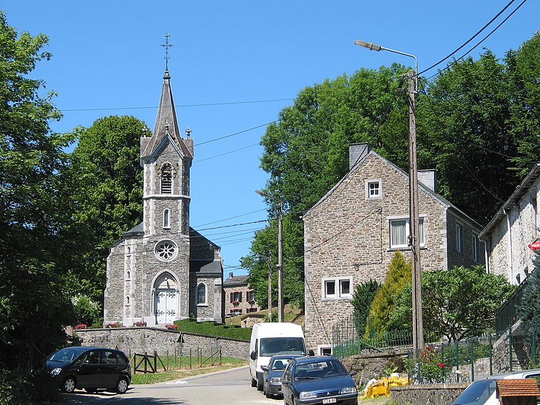
Sugny is a village in Vresse-sur-Semois, Arrondissement de Dinant, Wallonia and has about 565 residents. Sugny is situated nearby to the localities Wèbe dessus la Ville and Hultin.Photo: Jean-Pol GRANDMONT, CC BY 2.5.
- Type: Village with 565 residents
- Description: section of Vresse-sur-Semois, Belgium
- Postal code: 5550
Notable Places in the Area

Localities in the Area

Bohan sur Semois
Village

Photo: Jean-Pol GRANDMONT, CC BY 3.0.
Bohan-sur-Semois is a village of Wallonia and a district of Vresse-sur-Semois, located in the province of Namur, Belgium. Bohan sur Semois is situated 6 km north of Sugny.
Sugny
- Categories: municipality section and locality
- Location: Vresse-sur-Semois, Arrondissement de Dinant, Namur, Wallonia, Belgium, Benelux, Europe
- View on OpenStreetMap
Latitude
49.814° or 49° 48' 50" northLongitude
4.90329° or 4° 54' 12" eastPopulation
565Elevation
357 metres (1,171 feet)Open Location Code
8FX6RW73+J8OpenStreetMap ID
node 73813695OpenStreetMap Feature
place=villageGeoNames ID
2785915Wikidata ID
Q665054Sugny Satellite Map
© OpenStreetMap, Mapbox and Maxar
Also Known As
- Dutch: Sugny (Belgie)
- Dutch: Sugny
- French: Sugny
- Hungarian: Sugny
- Irish: Sugny
- Russian: Сюньи
- Walloon: Suni
- Vresse-sur-Semois (Sugny)
Other Places Named Sugny
Localities in the Area
- Wèbe dessus la VilleLocality
- HultinLocality
- HuttinLocality
- La PlancheLocality
- Le FauxLocality
Landmarks in the Area
- Église Saint-MartinChurch
- Replica de Grotte des LourdesChurch
- Rcs SugnyPitch
- Cimetière de la Fosse au LoupCemetery
- LavoirFountain
Escape to a Random Place
Discover other destinations in the world.
About Mapcarta. Thanks to Mapbox for providing amazing maps. Data © OpenStreetMap contributors and available under the Open Database License. Text is available under the CC BY-SA 4.0 license, excluding photos, directions and the map. Photo: Jean-Pol GRANDMONT, CC BY 2.5.