MyTopo
Classic USGS Camp Lejeune North Carolina 7.5'x7.5' Topo Map
Couldn't load pickup availability
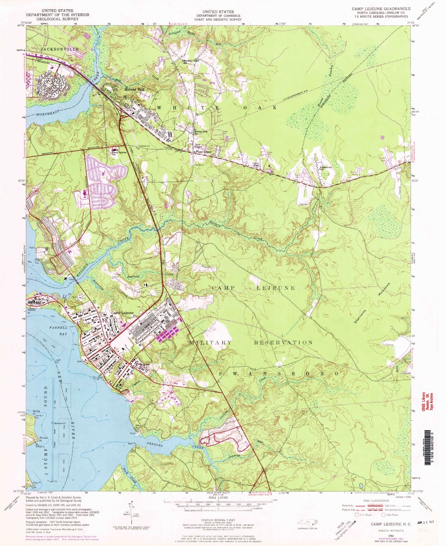
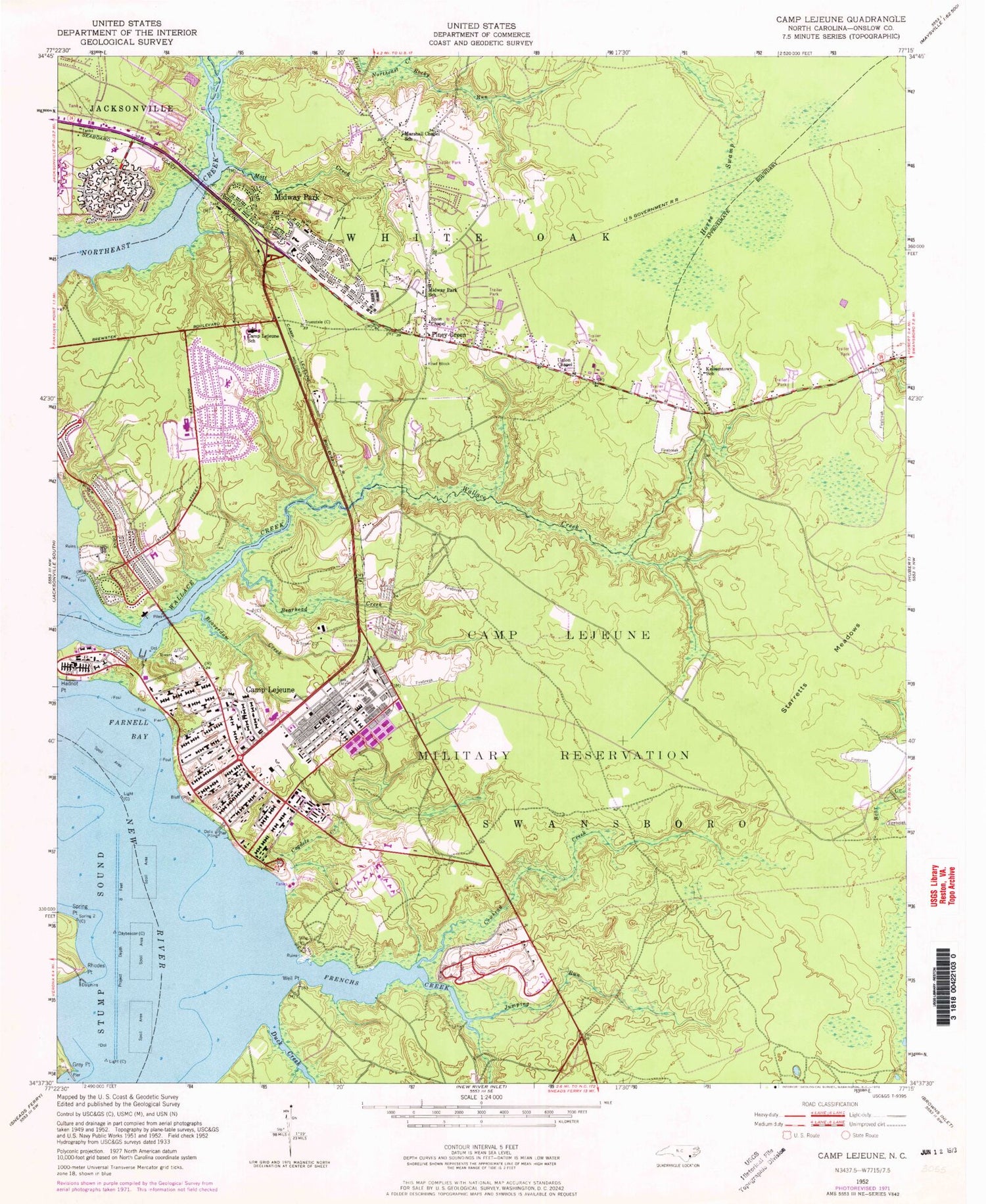
Historical USGS topographic quad map of Camp Lejeune in the state of North Carolina. Map scale may vary for some years, but is generally around 1:24,000. Print size is approximately 24" x 27"
This quadrangle is in the following counties: Onslow.
The map contains contour lines, roads, rivers, towns, and lakes. Printed on high-quality waterproof paper with UV fade-resistant inks, and shipped rolled.
Contains the following named places: Bearhead Creek, Beaverdam Creek, Berkeley Manor Area, Brynn Marr Hospital, Calvary Lutheran Church, Camp Lejeune Fire Department, Camp Lejeune Fire Department Station 2, Camp Lejeune Fire Department Station 3, Camp Lejeune Fire Department Station 5, Camp Lejeune Post Office, Camp Lejeune School, Cogdels Creek, Collins Estates Mobile Home Park, Cowhead Creek, Duck Creek, Enon Chapel, Farnell Bay, First Baptist Church, French Creek Post Office, Frenchs Creek, Grey Point, Holiday Mobile Home City, Horse Swamp, Hubert Volunteer Fire Department, James McDowell Jr Mobile Home Park, Johnson Primary School, Jumping Run, Kellumtown School, Lejeune High School, Little Northeast Creek, Marshall Chapel Baptist Church, Marshall Chapel School, Midville Baptist Church, Midway Park, Midway Park School, Mott Creek, Onslow County Emergency Medical Services Station 5, Pinewood Downs, Piney Green, Piney Green Census Designated Place, Piney Green Volunteer Fire Department, Ramseys Mobile Home Park, Rhodes Point, Rocky Run, Spring Branch, Spring Point, Starretts Meadows, Tarawa Terrace I, Tarawa Terrace Post Office, Tarawa Terrance Number 1 Elementary School, Union Chapel, United States Naval Hospital Camp Lejeune, Wallace Creek, Watkins Village, Weil Point, Whitehurst Creek, WJIK-AM (Camp Lejeune), ZIP Codes: 28544, 28547