
1
/
of
1
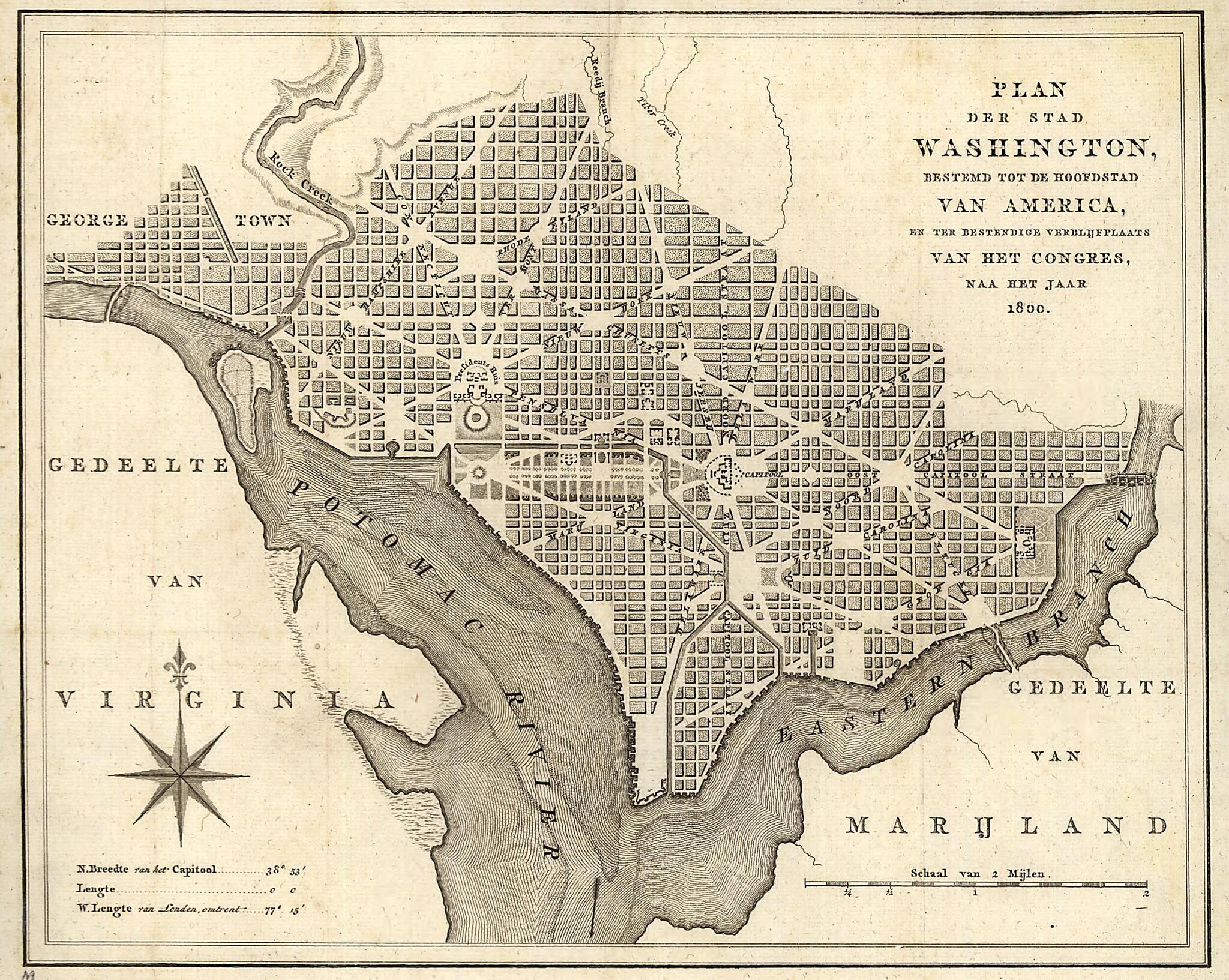
Plan Der Stad Washington : Bestemd Tot De Hoofdstad Van America, En Ter Bestendige Verblijfplaats Van Het Congres, Naa Het Jaar 1800 1793
- Regular price
-
$24.95 - Regular price
-
$37.95 - Sale price
-
$24.95
Map Description
Old early map of District of Columbia, Georgetown, Georgetown (Washington), United States, Washington, Washington D.C..
Created by A. Van Der Kroe in 1793.
Created by A. Van Der Kroe in 1793.
- Shows proposed government buildings.
- Relief shown by hachures.
- Also covers Georgetown.
- From A. van der Kroe's Vaderlandsche letter-oefeningen waarin boeken en schriften, Amsterdam, 1793.
- Includes latitude/longitude statement.
- Phillips. Washington 1287
Map Subjects
District Of Columbia
Early Maps
Early Works To 1800
Georgetown (Washington)
Georgetown (Washington D.C.)
United States
Washington
Washington (D.C.)
Georgetown
Washington D.C.
Early Maps
A. Van Der Kroe
1793
Map Tags
1793
A. Van Der Kroe
District Of Columbia
Early Maps
Early Works To 1800
Georgetown
Georgetown (Washington D.C.)
Georgetown (Washington)
Map
Maps
United States
Washington
Washington (D.C.)
Fine Art Quality
Printed on heavyweight (230 gsm) archival paper with a classic matte finish
Professionally Restored
For the best presentation, your map will be carefully retouched by our experienced team
Free Shipping
Orders of $75 or more ship for free and arrive in 3-5 business days
Proudly Made in the USA
All of our maps are custom printed to order in Portland, Maine
Couldn't load pickup availability
Secure Checkout
Lifetime Warranty
Money-Back Guarantee
Map Sizing Information
- For the best legibility, order your map in the original size or larger. Most maps have intricate detail and small text that is best appreciated when the print size hasn't been reduced.
- Sizes labeled "Fits a Standard Frame" will drop right into any frame that you purchase in that size. The sizes that we offer are commonly available online and at most retail stores.
- Our standard sizes are recommendations based on the aspect ratio of the original map, but still may require some added "white space" in one dimension to fit.
- Non-standard sizes will require custom framing, and we suggest taking your print to the frame shop of your choice after you receive it for the best results.
- Custom sizes are available, simply contact us for a quote.
Below is an approximation of the scale of a few standard sizes, and how they might appear in your space.
