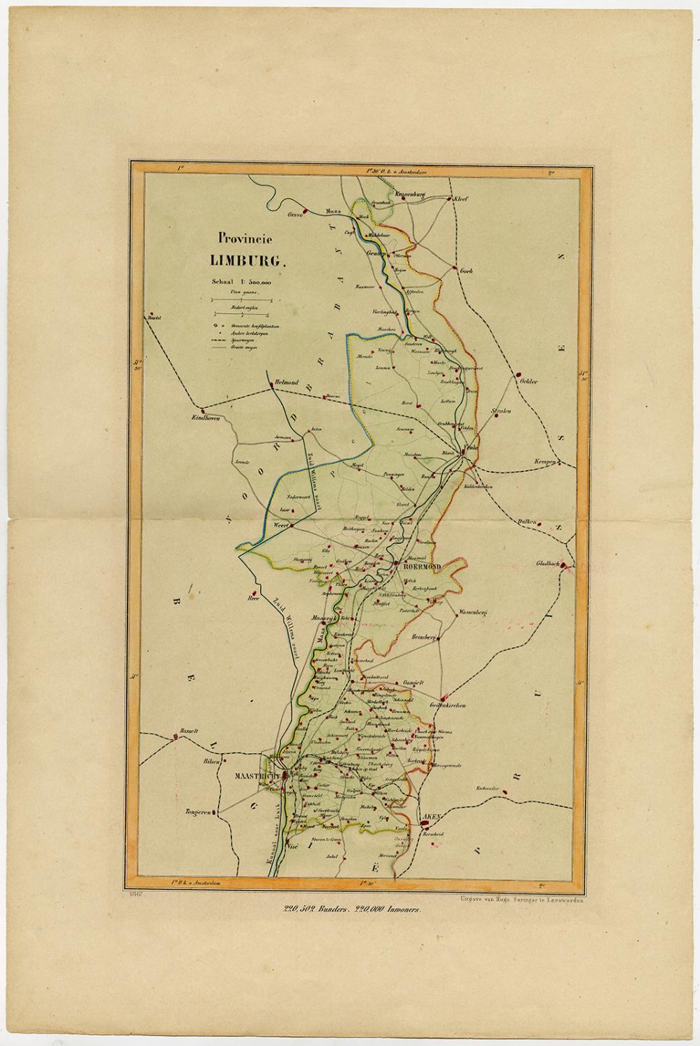
About this Item
Antique print, titled: 'Provincie Limburg.' - This map shows the province of Limburg, in the southern tip of the Netherlands. These scarse detailed maps of Dutch Towns originate from the 'Gemeente-atlas' of Jacob Kuyper. This atlas of all towns in the Netherlands was published from 1865-1870 and included all towns in the Dutch province of Limburg. These maps are also known as aKuyper kaartorKuyper kaartjesfrom Limburg. Handcoloured lithograph on wove paper. Made by an anonymous engraver after 'Jacob Kuyper'. Jacob Kuyper: He was one of the most important of the Dutch atlas editors of the second half of the 19th century. He is particularly known for the "Gemeente Atlas", with 1210 plans of all the towns and villages in the Netherlands. Very good, given age. Original middle fold, as issued. Light ghosting from previous matting, surrounding print. Remains of tape from previous attachment on rear. General age-related toning and/or occasional minor defects from handling. Please study scan carefully. The overall size is ca. 26.8 x 40.1 cm. The image size is ca. 18.2 x 29.3 cm. The overall size is ca. 10.6 x 15.8 inch. The image size is ca. 7.2 x 11.5 inch. Storage location: A335-01. Seller Inventory # 64678
Bibliographic Details
Title: Antique ...
Publication Date: 1865
Condition: Very Good
Store Description
Payment Methods
accepted by seller
PayPal Bank/Wire Transfer