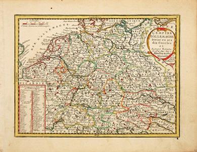
L'EMPIRE D'ALLEMAGNE Divise en ses dix Cercles.
CHIQUET, Jacques.
From Peter Harrington. ABA/ ILAB., London, United Kingdom
AbeBooks Seller Since July 26, 1999
Quantity: 1From Peter Harrington. ABA/ ILAB., London, United Kingdom
AbeBooks Seller Since July 26, 1999
Quantity: 1About this Item
Map of Germany showing the different provinces - 'cercles' as the map refers to them, with a list of the emperors at lower left and title cartouche at upper right. In the early eighteenth century, French cartography overtook the Dutch in terms of accuracy and design. Chiquet's delightful Nouveau et Curieux Atlas was typical product of the time. Moreland and Bannister, p.132 Copper engraving. Original colour with later additions. Fine condition, good margins. Size: 22 x 16.5 cm. (8½ x 6½ inches). Seller Inventory # 53278
Bibliographic Details
Title: L'EMPIRE D'ALLEMAGNE Divise en ses dix ...
Publisher: La Nouveau et Curieux Atlas Geographique et historique. [c.1719]
Store Description
All major credit cards are accepted. Both UK pounds and US dollars (exchange rate to be agreed) accepted. Books may be returned within 14 days of purchase for any reason, but please notify first of returned goods.
National and international delivery service is operational and unaffected by COVID-19. All shipped items are expertly packed and fully insured. All books to be sent by Recorded Delivery (UK) or signed-for Air Mail (overseas) service. UPS Express shipping also available. Packaging and insurance costs are included. Orders usually ship within 2 business days. Shipping costs are based on books weighing 2.2 LB, or 1 KG. If your book order is heavy or oversized, we may contact you to let you know extra shipping is required.
Payment Methods
accepted by seller
Check Money Order Bank Draft Bank/Wire Transfer