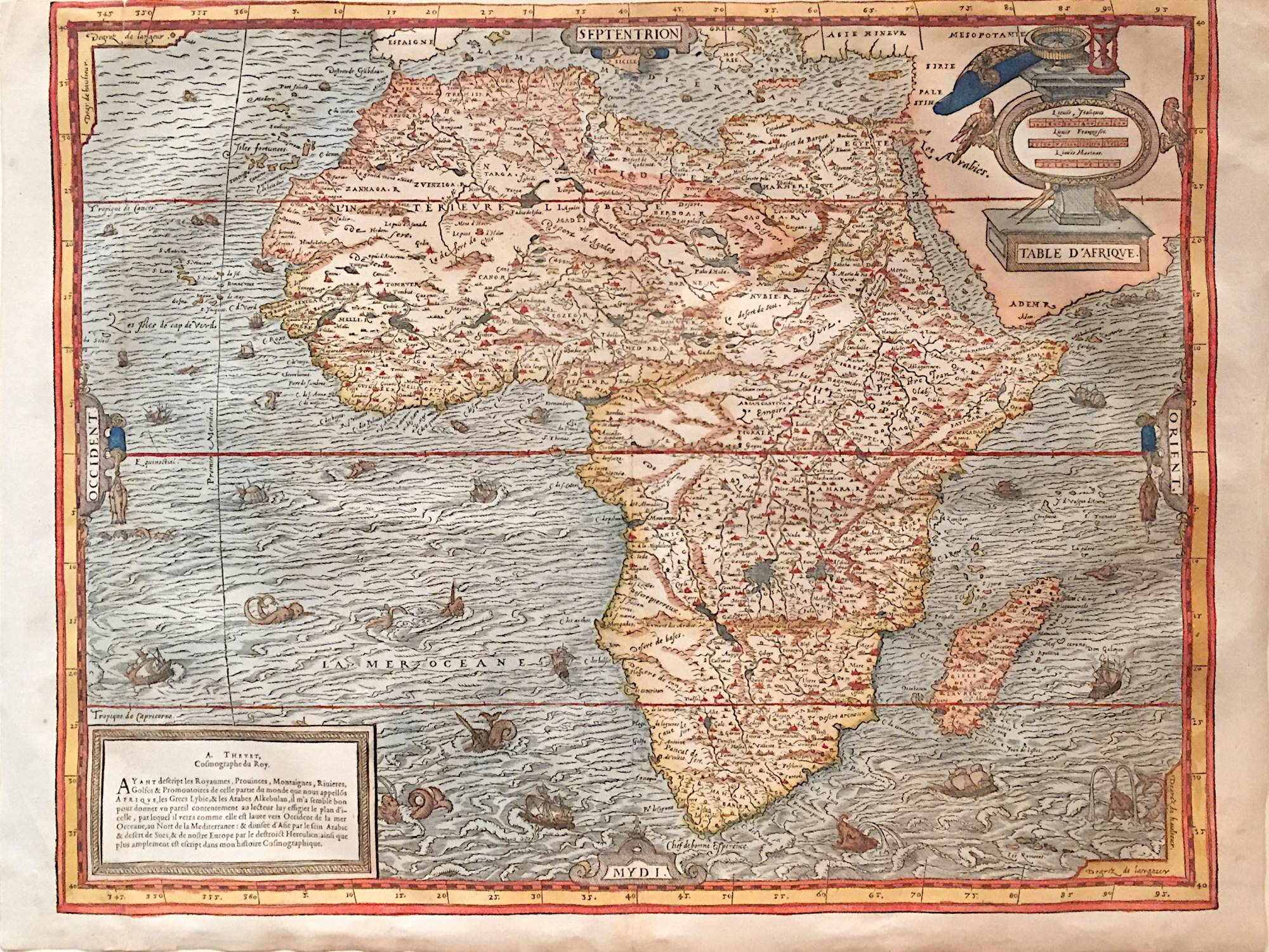
About this Item
Paris: Pierre L'Huilier/ Guillaume Chaudiere (?) 1575. Hand-colored woodcut map of AFRICA from Thevet's "Cosmographie Universelle," emulating Sebastian MUNSTER's famous description of the world from 1544. Condition: Fine except tear (repaired) in upper left quadrant and severely cut margin; 14 ¼ x 19 ½ inches. Double-page map of Africa with numerous ships and sea monsters, two cartouches including a compass, hourglass, and sea-chart, as well as strapwork decoration around the four cardinal directions. The shape of the continent displays an unusual bulge north of the Tropic of Capricorn and the mapping of the Nile follows the Ptolemaic tradition of locating its source in two parallel lakes fed by water from the legendary Mountains of the Moon. Born in Angoulême, André Thevet travelled in Europe and America, was appointed Cosmographe du Roi in 1560 and became an almoner to Catherine de' Medici. The FIRST map of Africa by a French cartographer. Seller Inventory # 6BD0025
Bibliographic Details
Title: Table d'Afrique
Publisher: Pierre L'Huilier/ Guillaume Chaudière (?), Paris
Publication Date: 1575
Binding: No binding
Condition: Very good
Store Description
All books are offered subject to prior sale and to price adjustments.
Free shipping is offered only on domestic sales (excluding Hawaii and Alaska) for octavo-sized material (i.e., roughly 2lb., with no dimension exceeding 10").
Larger and/or heavier books will incur a shipping sharge.
Books sent elsewhere will incur a shipping charge, according to their size and weight.
Payment Methods
accepted by seller