About this Item
Antique Map, titled: 'Carte des C.tes de Hainaut et de Namur et partie de Lyegeois, ou se trouvent Fontaine l'Eveque, Charleroy, Chastellet, Florennes, Walcourt [.].' - Map of a part of Haynaut and Namen. Map of a part of Haynaut and Namen. Hainaut. From: 'Atlas Portatif universel et militaire.', by Robert de Vaugondy, 1748. Engraving on laid paper. Published by 'The Vaugondy family'. Gilles Robert de Vaugondy (1688 - 1766), also known as Le Sieur or Monsieur Robert, and his son, Didier Robert de Vaugondy (c.1723 - 1786), were leading mapmakers in France during the 18th century. Very good, given age. Large margins. General age-related toning and/or occasional minor defects from handling. Please study scan carefully. The overall size is ca. 27.2 x 21.2 cm. The image size is ca. 18.8 x 17.6 cm. The overall size is ca. 10.7 x 8.3 inch. The image size is ca. 7.4 x 6.9 inch. Storage location: C4-13. Seller Inventory # 74420
Bibliographic Details
Title: 
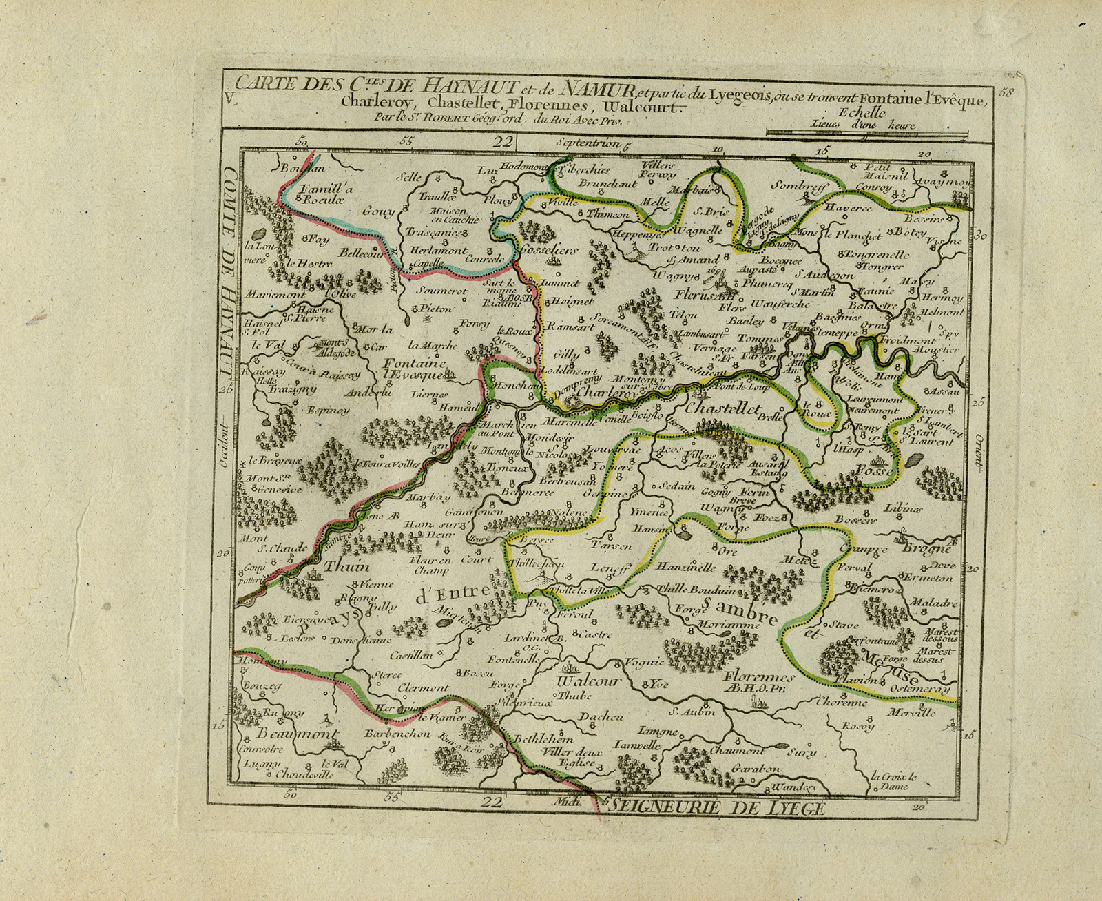
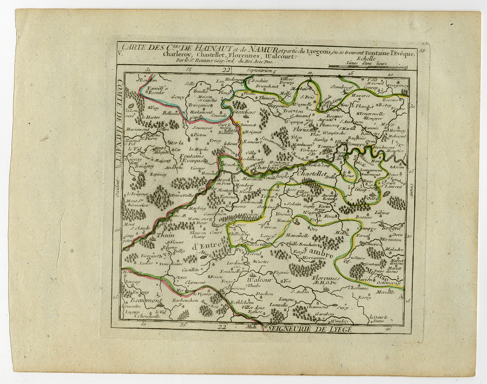
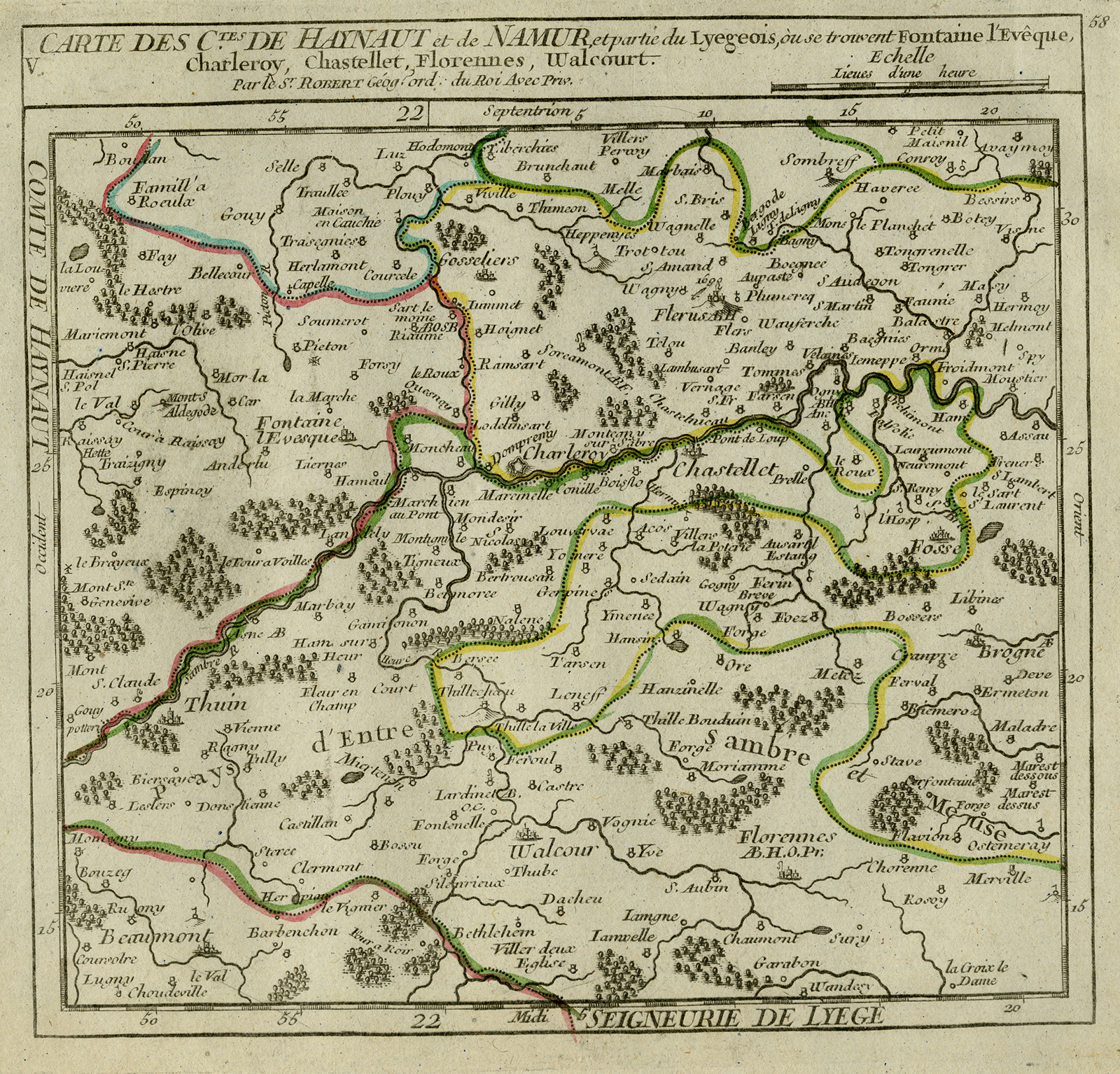
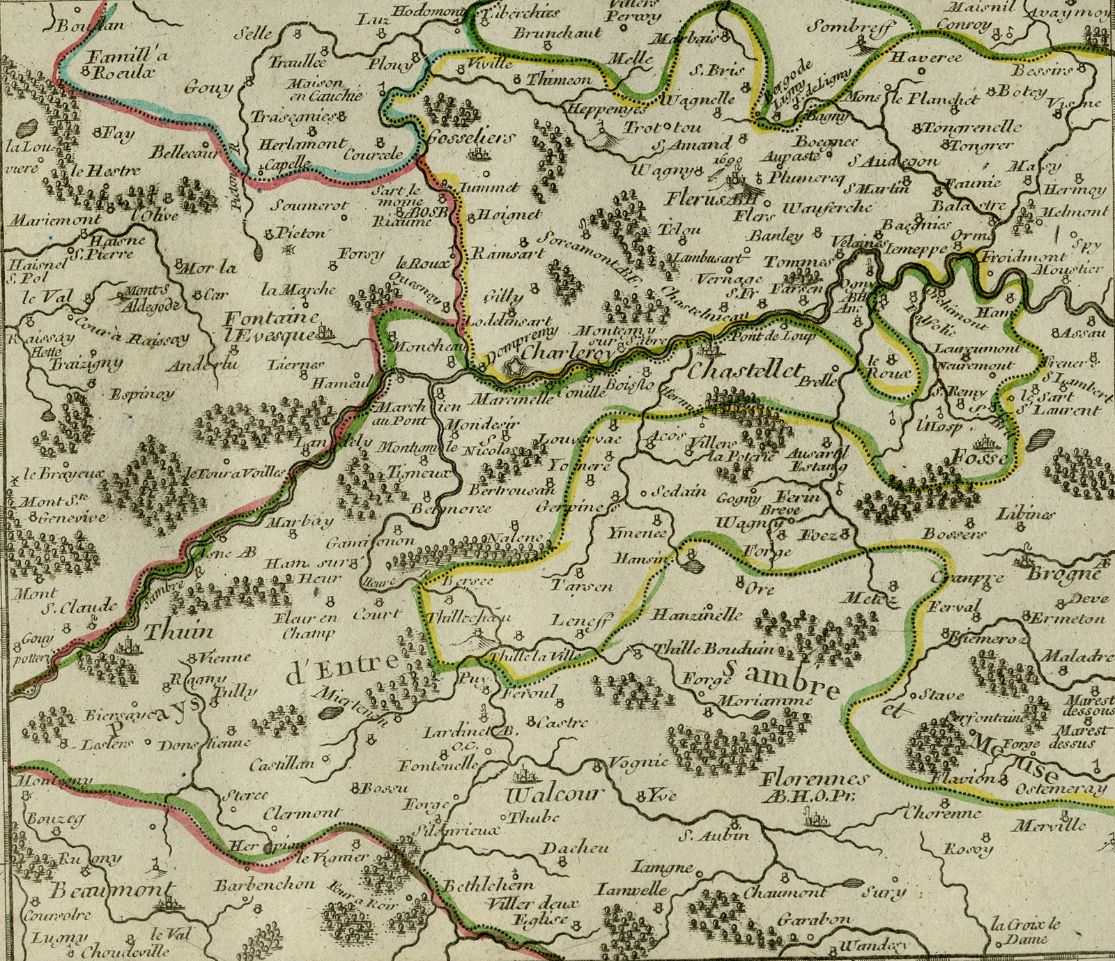
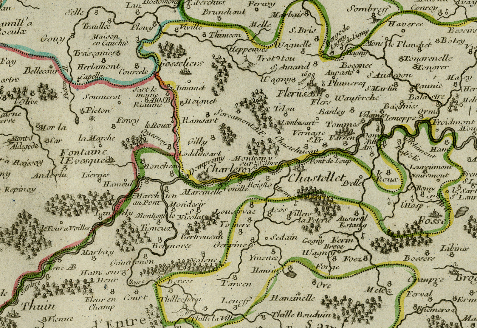
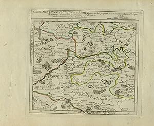
Antique Map-The provinces of Hainaut and ...
Publication Date: 1748
Condition: Very Good
Store Description
Payment Methods
accepted by seller
PayPal Bank/Wire Transfer