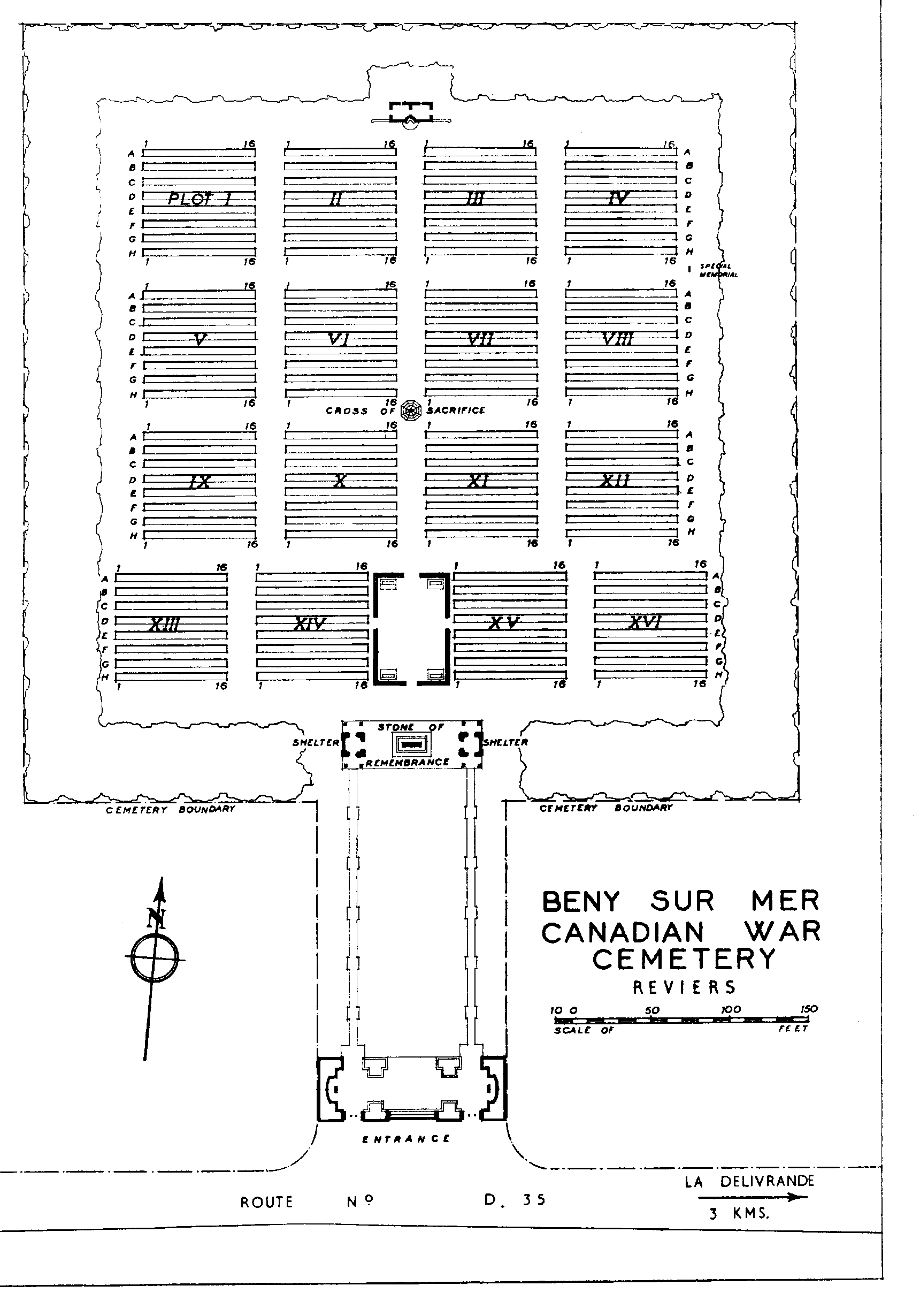
Beny-Sur-Mer Canadian War Cemetery, Reviers
- Country France
- Total identified casualties 2032 Find these casualties
- Region Calvados
- Identified casualties from Second World War
- GPS Coordinates Latitude: 49.30233, Longitude: -0.45061


Go on a virtual visit to Beny-sur-Mer Canadian War Cemetery
Beny-sur-Mer Canadian War Cemetery has Memory Anchor tours available using the FREE app for mobile phones and tablets. The tours cover different aspects of the site and the Commonwealth servicemen and women we commemorate within the grounds.
The app can be used remotely or, If you are visiting the cemetery, you can use the tour to follow a path around it, reading the stories along the route. There is also a scan function allowing the user to scan a headstone and bring up the related casualty information throughout the cemetery.
The Memory Anchor app can be downloaded from the links below.

Access the Beny-sur-Mer virtual tour via the Memory Anchor app, available on IOS and Android.
Download FREE app for iOS Download FREE app for Android

SHARE THE STORIES OF D-DAY AND NORMANDY
If you'd like to know more about who we commemorate, visit For Evermore: Stories of the Fallen, the CWGC online commemorative resource. Here you can read and share the fascinating stories from some of the people who took part in D-Day and Normandy Campaign.
Location information
Reviers is a village lying 18 kilometres east of Bayeux, 15 kilometres north west of Caen and 4 kilometres south of Courseulles-sur-Mer. The cemetery lies on the north side of the main road 1 kilometre east of Reviers.
Visiting information
ARRIVAL
The route to the cemetery is signposted.
PARKING
It is possible to park in an area along the front of the cemetery in a lay-by, where there are spaces for up to 5 vehicles. The ground is firm and flat with a red gravel topped surface.
The ground is flat, the surface is tarmac. There are small marker stones, approximately 200 mm tall between the lay-by and grass.
Additional parking can be found in a large car park where there are spaces for multiple vehicles on the right-hand side of the cemetery.
Access from the car park into the cemetery is through a 1.5 metre gap in the hedge, opening to inside the main entrance area.
ACCESS LAYOUT AND MAIN ENTRANCE
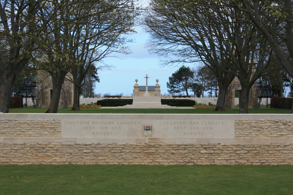
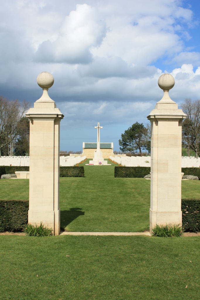
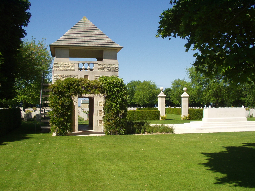
From the main road, access into the site is through two separate openings between stone columns on either side of a central wall.
Grass gently slopes up to the paved area in front of the two entrance openings, with a single step up to the bollards.
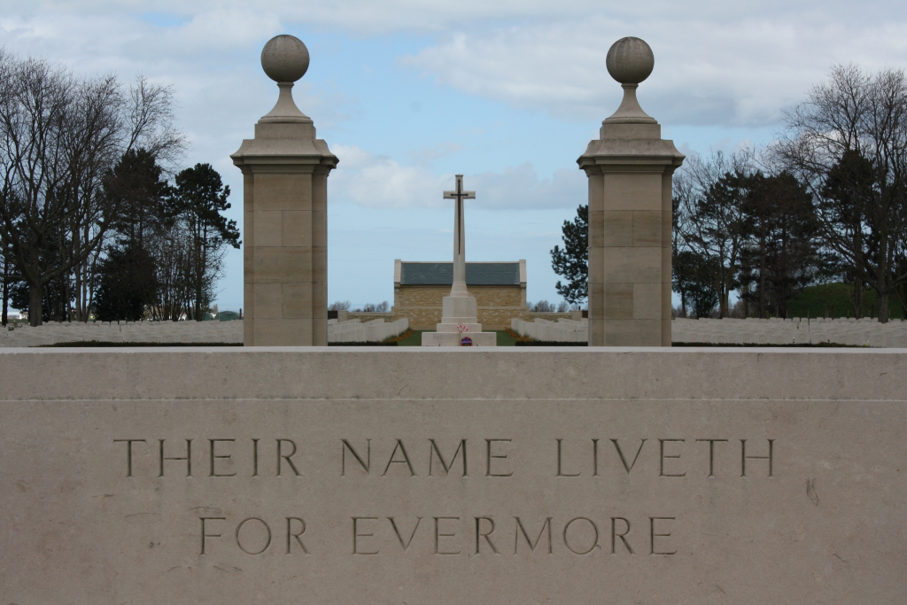
There is a gap between each set of stone pillars, with 2 stone bollards in the centre and a removable chain between the bollards. The widest opening is between the bollards; approximately 1 metre wide.
Once through the entrance, there is a wide grassed and tree-lined area, with narrow strips of paving surrounding grass. There is a large seating area immediately behind the main entrance central wall, on a raised plinth accessed by two steps. The grassed area is approximately 50 metres long and leads to the main entrance: two stone shelter buildings with elevated viewing platforms and a Stone of Remembrance between them.
There is seating inside the two shelters.
Access to the viewing platforms is via metal staircases attached to the shelter buildings. There is a level platform midway up the stairs. Handrails are located on either side of the stairs.
The Register Box is located inside the left-hand side shelter building looking towards the cemetery.
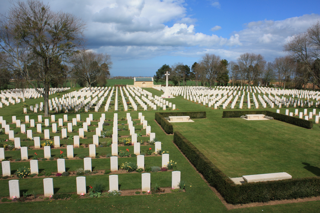
There is an enclosed area surrounded by a low-level hedge with openings on all four sides, with stone benches in each corner.
The Cross of Sacrifice is in centre of cemetery, and stone seating areas at each side of the cemetery in line with the Cross.
There is a stone building at the rear of the cemetery, in line with the Cross of Sacrifice and main entrance, with a semi-circular stone bench built into the wall, facing towards the cemetery.
The cemetery ground surface is flat and firm, all internal paths have a grass surface and are firm and flat.
ALTERNATIVE ACCESS
There is a side entrance from car park into the cemetery, where there is a gap in the hedge with a path from the car park into cemetery.
The alternative entrance leads to just inside the right side of the main entrance from the road. The ground is flat and level, the surface changes from tarmac to stone paving to grass.
ADDITIONAL INFORMATION
The cemetery is permanently open.
History information
The Allied offensive in north-western Europe began with the Normandy landings of 6 June 1944.
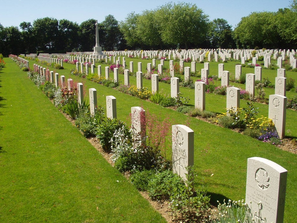
Many of those buried in Beny-sur-Mer Canadian War Cemetery were men of the 3rd Canadian Division who died either on 6 June or during the early days of the advance towards Caen, when the Division engaged a German battle group formed from the 716th Division and the 21st Panzer Division.
The cemetery, designed by P.D. Hepworth, contains 2,048 Second World War burials, the majority Canadian, and 19 of them unidentified.